|
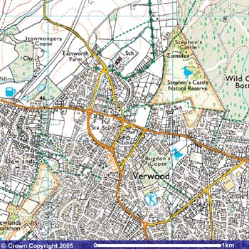
 VERWOOD, (Developed from
FAIRWOOD, FAYRWOOD, WRTWOOD & WEIRWOOD) was first
recorded in 1329 and is situated on the far eastern boundary
of Dorset near the Hampshire border, five miles north-west
of Ringwood and about twelve miles north of Bournemouth. It
became a Civic Parish in l894. Previously it's history was
recorded under Cranborne. VERWOOD, (Developed from
FAIRWOOD, FAYRWOOD, WRTWOOD & WEIRWOOD) was first
recorded in 1329 and is situated on the far eastern boundary
of Dorset near the Hampshire border, five miles north-west
of Ringwood and about twelve miles north of Bournemouth. It
became a Civic Parish in l894. Previously it's history was
recorded under Cranborne.
Its ALTITUDE above sea level
varies between 70 and 130 feet. The CLIMATE is mild and the
average RAINFALL is approximately 32 inches.
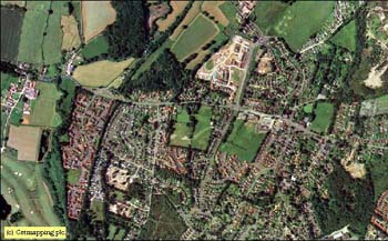
To the north and east lie areas
of coniferous forests and to the west are mixed farms. There
are two tracks of heath which are of Special Scientific
Interest.
 For centuries it was a small,
scattered settlement whose inhabitants made a living from
the surrounding heathland. The clay and sand deposits
gave rise to potteries and brick and tile yards in the early
1900's, with the heath providing materials for besom making,
fodder & peat. Eventually it became the centre of
production of the distinctive yellowy-green glazed pots.
Potters, brickmakers, broom makers and the like all plied
their trades alongside the traditional agricultural
workers. Today it is a fast growing town of some
14,000 and rising. For centuries it was a small,
scattered settlement whose inhabitants made a living from
the surrounding heathland. The clay and sand deposits
gave rise to potteries and brick and tile yards in the early
1900's, with the heath providing materials for besom making,
fodder & peat. Eventually it became the centre of
production of the distinctive yellowy-green glazed pots.
Potters, brickmakers, broom makers and the like all plied
their trades alongside the traditional agricultural
workers. Today it is a fast growing town of some
14,000 and rising.
Development of Verwood is
relatively recent and it was only in the last century that
the settlement built its own small cob church which was
consecrated in 1829. Till then the village, together with
Alderholt, had been part of the huge parish of Cranborne.
Parochial Status for Verwood was granted in 1887.
|
Many thanks to
the "Verwood Historical Society" who
provided the following information. |
Verwood was mentioned in a
charter of 1377 as “Fairwoode” though the name of its
Norman landowners the “Beau Bois” family of Edmondsham
is recorded earlier. This family was also known by the Latin
name of Bello Bosco. In any language the meaning is a Fair
or Beautiful Wood. The later adoption of the spelling
Verwood is due to its long time pronunciation in the Dorset
Tongue.
This was never a village grouped around a long
established church but a collection of scattered settlements
bisected by the fertile farmlands of the River Crane and
equidistant from the market towns of Ringwood and Cranborne
in whose parish it lay until 1887. An Anglican Chapel of
Ease had been erected in 1829 on the site of the present
Parish
Church
and several Nonconformist Chapels were
also established within its boundaries. The Ecclesiastical
and Civil administrative area has always included Three
Legged Cross.
Verwood owes its character and development to
its situation on the heathlands of
East Dorset
and has a surprisingly industrial past.
Apart from the meadows around the river valley, its acid
soil was unsuitable to large scale agriculture and so
various smaller enterprises grew up over the years, making
use of the natural features beneath and above the commons.
Clay, sand, timber, heather and
gorse were utilized by craftsmen to fashion into pots,
bricks, brooms, hurdles, farm implements and even provided
building material for the cottages they lived in. Fodder was
collected and animals pastured on many acres of scryb land
unlike other more productive settlements where Enclosure
Acts had deprived the population of these additional sources
of income.
It was therefore, an area which
attracted newcomers over the 18th and 19th
centuries because of the comparative lack of restriction on
their settlement and occupation. The population of 400 in
1829 grew by the end of the century to 1000 and fifty years
later had doubled this figure. With development from the
1960’s onward the numbers began to increase dramatically
leading to an estimated population in 1999 of over 12,000.
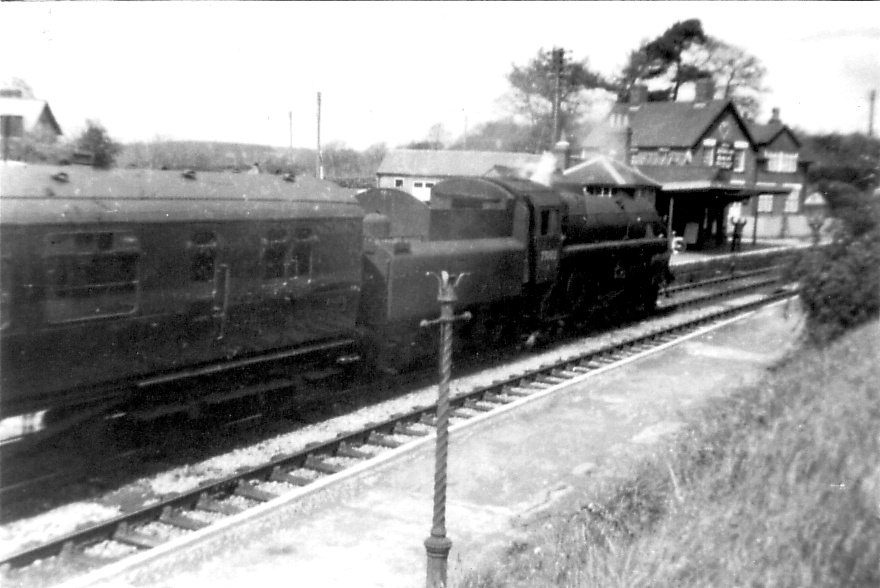
 The railway from
Salisbury
to the coast arrived in 1866 and
heralded a change in Verwood’s fortunes. More goods could
be imported and exported but ironically this contributed to
the demise of the potteries when lighter, manufactured
household ware became readily available. The railway from
Salisbury
to the coast arrived in 1866 and
heralded a change in Verwood’s fortunes. More goods could
be imported and exported but ironically this contributed to
the demise of the potteries when lighter, manufactured
household ware became readily available.
High quality Verwood sand was taken to
South Wales
for use in the glass and brickmaking
industries. It was also used for the construction of
Mulberry Harbours in WWII. The railway line and station
closed in 1964 to the natural regret of the local
population
The last pottery at the Crossroads ceased production in
1952.
The flourishing brick and
roofing tile works, which depended on continuous firing
could no longer operate under World War ii blackout
regulations and were never re-opened.
Broom making died out during the
course of the 20th century as demand receded and
sons followed other trades. Bricks began to supplant the
traditional mud “cob” mixture as the indigenous building
material.
Verwood no longer provides the
full employment it once did for its working population. In
these days of enhanced transport and leisure time it seen as
a desirable place to live and conveniently situated for the
many attractions of the surrounding neighbourhood. In many
aspects, despite enormous changes, the village atmosphere
still prevails.
Those who doubt that Verwood is
still a “Fair Wood” need only to climb to the top of
Stephen’s Castle on the Northern common.
From that tranquil viewpoint,
scarcely a roof is to be seen of all the myriad buildings
nestling beneath a canopy of delightfully varied foliage.
|