|
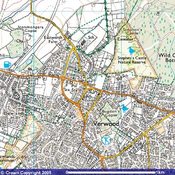
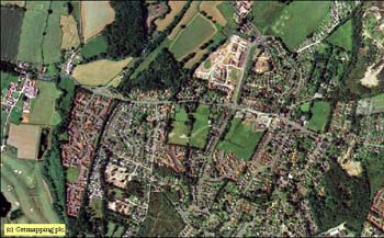
 VERWOOD,
(Developed from FAIRWOOD, FAYREWOOD, WRTWOOD & WEIRWOOD)
was first recorded in 1329 and is situated on the far
eastern boundary of Dorset near the Hampshire border. VERWOOD,
(Developed from FAIRWOOD, FAYREWOOD, WRTWOOD & WEIRWOOD)
was first recorded in 1329 and is situated on the far
eastern boundary of Dorset near the Hampshire border.
Verwood is
five miles north-west of Ringwood and about twelve miles
north of Bournemouth and became a Civic Parish in
1894.
Previously
it's history was recorded under Cranborne.
Its ALTITUDE
above sea level varies between 70 and 130 feet. The CLIMATE
is mild and the average RAINFALL is approximately 32
inches.
To the north
and east lie areas of coniferous forests and to the west are
mixed farms. There are two tracks of heath which are of
Special Scientific Interest.
 For centuries Verwood was a small, scattered
settlement whose inhabitants made a living from the
surrounding heathland. For centuries Verwood was a small, scattered
settlement whose inhabitants made a living from the
surrounding heathland.
The clay and
sand deposits gave rise to potteries and brick and tile
yards in the early 1900's, with the heath providing
materials for besom making, fodder & peat.
Eventually it
became the centre of production of the distinctive
yellowy-green glazed pots. Potters, brickmakers, broom
makers and the like all plied their trades alongside the
traditional agricultural workers.
Today it is a
fast growing town of some 14,000 and rising.
Development
of Verwood is relatively recent and it was only in the last
century that the settlement built its own small cob church
which was consecrated in 1829. Until then the village,
together with Alderholt, had been part of the huge parish of
Cranborne. Parochial Status for Verwood was granted in 1887.
Go to the History site for more
information
|